Home > Arts > Artists > O > Abraham Ortelius
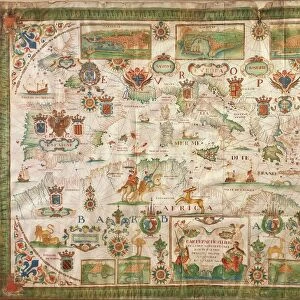
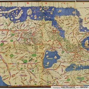
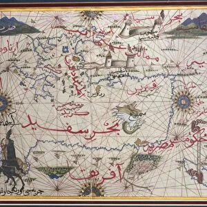
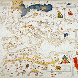
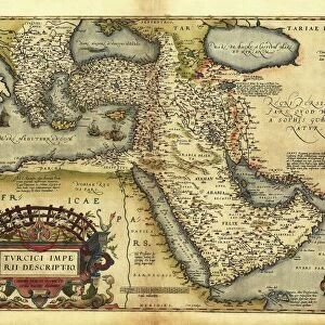
Map of the Nile Delta and of ancient city of Carthage, from Theatrum Orbis Terrarum by Abraham Ortelius, 1528-1598, Antwerp, 1570

![]()
Wall Art and Photo Gifts from Universal Images Group (UIG)
Map of the Nile Delta and of ancient city of Carthage, from Theatrum Orbis Terrarum by Abraham Ortelius, 1528-1598, Antwerp, 1570
Cartography, 16th century. Map of the Nile Delta and of ancient city of Carthage, from Theatrum Orbis Terrarum by Abraham Ortelius (1528-1598), Antwerp, 1570
Universal Images Group (UIG) manages distribution for many leading specialist agencies worldwide
Media ID 9570615
© DEA / A. DAGLI ORTI
16th Century Carthage Latin Script Manuscript Nile River
FEATURES IN THESE COLLECTIONS
> Arts
> Artists
> O
> Abraham Ortelius
> Arts
> Landscape paintings
> Waterfall and river artworks
> River artworks
> Maps and Charts
> Abraham Ortelius
> Universal Images Group (UIG)
> Art
> Painting, Sculpture & Prints
> Cartography
EDITORS COMMENTS
This print showcases a remarkable piece of cartographic history - the Map of the Nile Delta and ancient city of Carthage. Created by Abraham Ortelius, a renowned Flemish cartographer from Antwerp in the late 16th century, this map is an exquisite example of his influential work. Ortelius's masterpiece, featured in Theatrum Orbis Terrarum, takes us on a journey through time and space. With intricate detail and precision, he beautifully captures the physical geography of the Nile Delta region as well as the ancient city of Carthage. This map serves as both an invaluable historical document and a stunning piece of art. The composition is horizontal, allowing viewers to immerse themselves in every minute detail presented before them. Through careful brushstrokes and delicate use of color, Ortelius breathes life into this illustration. The Latin script adds an air of authenticity to this manuscript-like creation. As we gaze upon this image, we are transported back to a time when exploration was at its peak. It reminds us that maps were not just tools for navigation but also works of art that celebrated human curiosity about our world. In this particular rendition from Universal Images Group (UIG), no people are present; instead, it focuses solely on showcasing the magnificence and significance behind Ortelius's creation. Let this photograph print serve as a reminder that even centuries later, these historical artifacts continue to captivate our imagination with their timeless beauty.
MADE IN THE USA
Safe Shipping with 30 Day Money Back Guarantee
FREE PERSONALISATION*
We are proud to offer a range of customisation features including Personalised Captions, Color Filters and Picture Zoom Tools
SECURE PAYMENTS
We happily accept a wide range of payment options so you can pay for the things you need in the way that is most convenient for you
* Options may vary by product and licensing agreement. Zoomed Pictures can be adjusted in the Cart.