Home > Arts > Artists > B > Joan Blaeu
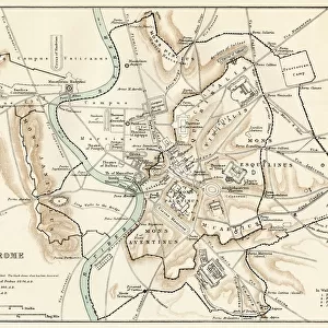
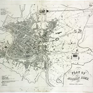
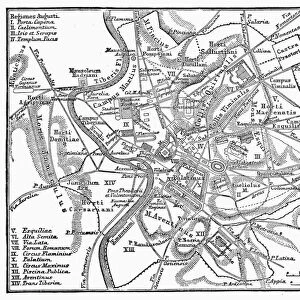
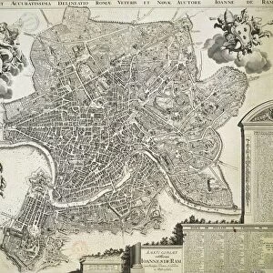
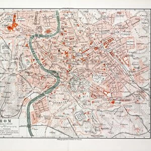
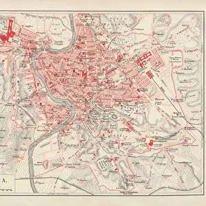
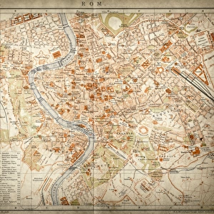
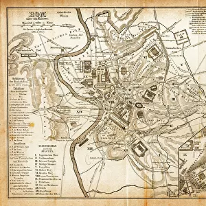
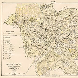
Map of Rome, engraving from Theatrum civitatum et admirandorum Italiae by Joan Blaeu, printed in Italy, 17th Century

![]()
Wall Art and Photo Gifts from Universal Images Group (UIG)
Map of Rome, engraving from Theatrum civitatum et admirandorum Italiae by Joan Blaeu, printed in Italy, 17th Century
Cartography, Italy, 17th century. Map of Rome, from Theatrum civitatum et admirandorum Italiae by Joan Blaeu. Engraving
Universal Images Group (UIG) manages distribution for many leading specialist agencies worldwide
Media ID 9504399
© DEA PICTURE LIBRARY
17th Century Aerial View Capital Cities Cityscape Direction Guidance Joan Blaeu Rome Western Script River Tiber
FEATURES IN THESE COLLECTIONS
> Architecture
> Country
> Italy
> Rome
> Arts
> Artists
> B
> Joan Blaeu
> Arts
> Landscape paintings
> Waterfall and river artworks
> River artworks
> Europe
> Italy
> Aerial Views
> Europe
> Italy
> Lazio
> Rome
> Universal Images Group (UIG)
> Art
> Painting, Sculpture & Prints
> Cartography
EDITORS COMMENTS
This print showcases a remarkable piece of cartographic history - the Map of Rome from the 17th century. Engraved by Joan Blaeu and printed in Italy, this exquisite artwork is a testament to the intricate craftsmanship and attention to detail prevalent during that era. The map offers a fascinating aerial view of Rome, allowing us to navigate through its winding streets and iconic landmarks. With its horizontal orientation, it provides an expansive perspective on the city's layout, architecture, and physical geography. The River Tiber gracefully meanders through the heart of Rome, dividing it into distinct sections. As we explore this historical treasure, we are transported back in time to an era when maps served as invaluable tools for navigation and guidance. This particular map would have been essential for travelers seeking direction within the bustling capital city or those intrigued by its rich history. The absence of people in this image allows us to focus solely on the magnificent cityscape depicted before us. Every building is meticulously illustrated with Western script labels providing further insight into Rome's significant sites. With its blend of artistry and functionality, this engraving exemplifies how cartography can be both informative and aesthetically pleasing. It serves as a reminder of our enduring fascination with maps as windows into different times and places
MADE IN THE USA
Safe Shipping with 30 Day Money Back Guarantee
FREE PERSONALISATION*
We are proud to offer a range of customisation features including Personalised Captions, Color Filters and Picture Zoom Tools
SECURE PAYMENTS
We happily accept a wide range of payment options so you can pay for the things you need in the way that is most convenient for you
* Options may vary by product and licensing agreement. Zoomed Pictures can be adjusted in the Cart.