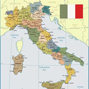
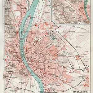
Home > Arts > Artists > O > Abraham Ortelius
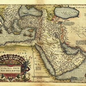
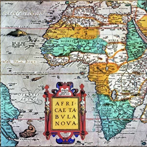
Map of Hungary, 1570 (engraving)
")
![]()
Wall Art and Photo Gifts from Fine Art Finder
Map of Hungary, 1570 (engraving)
LRI4704855 Map of Hungary, 1570 (engraving) by Ortelius, Abraham (1527-98); Museo Navale di Pegli, Genoa, Italy; (add.info.: Hungarian Descriptio, Wolfgango Lazio Auct. Geography map of the territory of Hungary from " Theatrum Orbis Terrarum" by Abraham Ortelius (Oertel, Ortell or Ortel, 1527-1598), 1570. Genova, Museo Navale); Luisa Ricciarini; Flemish, out of copyright
Media ID 22278494
© Luisa Ricciarini / Bridgeman Images
Atlas Book Hungarian Hungary Geographical Map
FEATURES IN THESE COLLECTIONS
> Arts
> Artists
> O
> Abraham Ortelius
> Europe
> Hungary
> Related Images
> Europe
> Italy
> Lazio
> Related Images
> Europe
> Italy
> Liguria
> Genoa
> Fine Art Finder
> Artists
> Abraham Ortelius
> Maps and Charts
> Abraham Ortelius
EDITORS COMMENTS
This print showcases a remarkable piece of history, the "Map of Hungary, 1570". Created by Abraham Ortelius, a renowned Flemish cartographer and geographer of the 16th century, this engraving provides an intricate depiction of the Hungarian territory during that time. Ortelius' map is part of his famous work "Theatrum Orbis Terrarum" which was considered one of the first modern atlases. This particular map, known as Hungarian Descriptio, offers a comprehensive geographical representation with meticulous attention to detail. It serves as a valuable resource for understanding Hungary's landscape and boundaries in the late 16th century. Displayed at Museo Navale di Pegli in Genoa, Italy, this print captures every element with precision and clarity. The expertise behind its creation is evident through Luisa Ricciarini's skillful photography. By preserving this historical artifact through her lens, Ricciarini allows us to appreciate both Ortelius' artistry and her own talent in capturing such delicate details. As we gaze upon this image today, we are transported back in time to explore Hungary's past. From its majestic rivers to its sprawling mountains and vibrant cities, this map reveals not only geographic information but also glimpses into cultural heritage and historical significance. It serves as a testament to human curiosity and our desire to understand the world around us throughout different eras.
MADE IN THE USA
Safe Shipping with 30 Day Money Back Guarantee
FREE PERSONALISATION*
We are proud to offer a range of customisation features including Personalised Captions, Color Filters and Picture Zoom Tools
SECURE PAYMENTS
We happily accept a wide range of payment options so you can pay for the things you need in the way that is most convenient for you
* Options may vary by product and licensing agreement. Zoomed Pictures can be adjusted in the Cart.