Home > Europe > United Kingdom > England > London > Towns > Primrose Hill
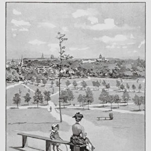
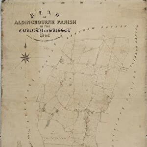
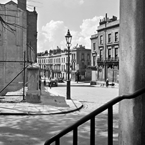
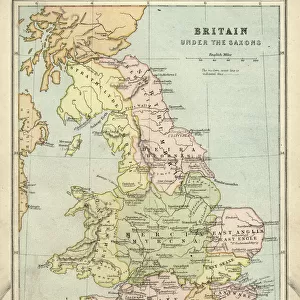
Map of Regents Park and Primrose Hill (litho)
")
![]()
Wall Art and Photo Gifts from Fine Art Finder
Map of Regents Park and Primrose Hill (litho)
7163735 Map of Regents Park and Primrose Hill (litho) by English School, (20th century); Private Collection; (add.info.: Map of Regents Park and Primrose Hill. Illustration for The Regents Park and Primrose Hill, History and Antiquities, by A D Webster (Greening, 1911).); © Look and Learn
Media ID 24733480
© Look and Learn / Bridgeman Images
City Map City Plan General Map Street Plan
FEATURES IN THESE COLLECTIONS
> Arts
> Portraits
> Pop art gallery
> Street art portraits
> Europe
> United Kingdom
> England
> London
> Boroughs
> City of London
> Europe
> United Kingdom
> England
> London
> Sights
> Green Park
> Europe
> United Kingdom
> England
> London
> Sights
> Regents Park
> Europe
> United Kingdom
> England
> London
> Towns
> Primrose Hill
> Europe
> United Kingdom
> England
> Maps
> Europe
> United Kingdom
> Maps
> Fine Art Finder
> Artists
> English School
> Maps and Charts
> Early Maps
> Maps and Charts
> Related Images
EDITORS COMMENTS
This black and white lithograph print showcases a detailed map of Regents Park and Primrose Hill, offering a glimpse into the rich history and beauty of these iconic London landmarks. Created by an English School artist in the early 20th century, this print is part of a private collection. The map provides a fascinating insight into the layout and design of Regents Park and Primrose Hill during that time period. It was originally featured as an illustration in "The Regents Park and Primrose Hill, History and Antiquities" by A. D. Webster, published in 1911. With its intricate details, this map allows us to explore the streets, pathways, gardens, and architectural features that make up these renowned areas of London. It serves as both a historical document and a visual delight for anyone interested in the city's past. As we study this lithograph print further, we can appreciate the skillful artistry involved in creating such intricate illustrations using lithography techniques. The use of black-and-white adds to its timeless charm while highlighting important landmarks within the city plan. Whether you are a Londoner or simply fascinated by European history, this map offers an opportunity to immerse yourself in the enchanting world of Regents Park and Primrose Hill during the early 20th century.
MADE IN THE USA
Safe Shipping with 30 Day Money Back Guarantee
FREE PERSONALISATION*
We are proud to offer a range of customisation features including Personalised Captions, Color Filters and Picture Zoom Tools
SECURE PAYMENTS
We happily accept a wide range of payment options so you can pay for the things you need in the way that is most convenient for you
* Options may vary by product and licensing agreement. Zoomed Pictures can be adjusted in the Cart.