Home > Europe > France > Maps
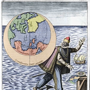
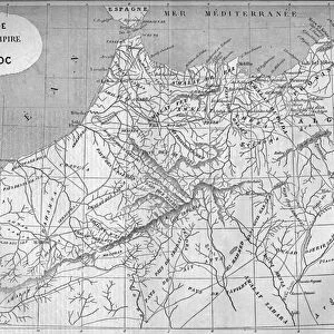
Europe after the invasion of the barbarians in the 6th century - Plate extracted

![]()
Wall Art and Photo Gifts from Fine Art Finder
Europe after the invasion of the barbarians in the 6th century - Plate extracted
XEE4152134 Europe after the invasion of the barbarians in the 6th century - Plate extracted from " Universal Atlas of Ancient and Modern Geography for the Use of Residential Schools" by Vuillemin - around 1845 by French School, (19th century); Private Collection; (add.info.: Europe after the invasion of the barbarians in the 6th century - Plate extracted from " Universal Atlas of Ancient and Modern Geography for the Use of Residential Schools" by Vuillemin - around 1845); Stefano Bianchetti; French, out of copyright
Media ID 22297408
© Stefano Bianchetti / Bridgeman Images
6th 6th 6th Vi Vith Vith Century Atlas Book Geographical Map
FEATURES IN THESE COLLECTIONS
> Fine Art Finder
> Artists
> French School
> Maps and Charts
> Early Maps
> Maps and Charts
> Related Images
EDITORS COMMENTS
This print showcases a historical map titled "Europe after the invasion of the barbarians in the 6th century". Taken from the renowned "Universal Atlas of Ancient and Modern Geography for the Use of Residential Schools" by Vuillemin, this plate offers a glimpse into Europe's transformation during a tumultuous period. Created around 1845 by French School artists, this piece now resides in a private collection. The map depicts Europe during the Middle Ages, specifically focusing on the aftermath of barbarian invasions that occurred in the 6th century. It provides valuable insights into how these invasions reshaped European geography and influenced its political landscape. With intricate engravings and meticulous attention to detail, this medium-sized atlas book plate is an exceptional example of cartographic artistry. The work captures not only geographical information but also reflects cultural exchanges between different regions. Stefano Bianchetti skillfully captured this photograph, ensuring that viewers can appreciate every nuance and historical significance embedded within this artwork. As we explore this image, we are transported back in time to witness Europe's evolution amidst turbulent times. This print serves as a testament to both artistic excellence and historical documentation. Its presence reminds us of our collective past while offering invaluable educational opportunities for those interested in understanding Europe's complex history.
MADE IN THE USA
Safe Shipping with 30 Day Money Back Guarantee
FREE PERSONALISATION*
We are proud to offer a range of customisation features including Personalised Captions, Color Filters and Picture Zoom Tools
SECURE PAYMENTS
We happily accept a wide range of payment options so you can pay for the things you need in the way that is most convenient for you
* Options may vary by product and licensing agreement. Zoomed Pictures can be adjusted in the Cart.