Home > Arts > Artists > M > Gerardus Mercator
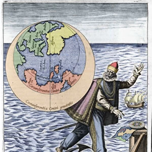
Globe, 16th century (wood, metal, engraving)
")
![]()
Wall Art and Photo Gifts from Fine Art Finder
Globe, 16th century (wood, metal, engraving)
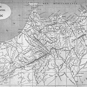
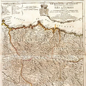
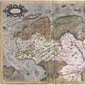
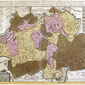
AIS5338586 Globe, 16th century (wood, metal, engraving) by Mercator, Gerardus (1512-94); 64 x 55 cm; Mercatormuseum, Sint-Nikls, Belgium; (add.info.: Globe made by Gerhard Kremer said Gerard Mercator (1512-1594) Dimensions: 64 x 55 cm. Diameter: 41 cm. Photography Belgium, Flanders, St. Nikls (or Sint-Nikls) Mercatormuseum.); eIberfoto; Flemish, out of copyright
Media ID 22335316
© Iberfoto / Bridgeman Images
Earth Globe Globe Of The Earth Geographical Map Thing
FEATURES IN THESE COLLECTIONS
> Arts
> Artists
> M
> Gerardus Mercator
> Europe
> Belgium
> Related Images
> Fine Art Finder
> Artists
> Gerardus Mercator
> Fine Art Finder
> Artists
> Mexican School
> Maps and Charts
> Gerardus Mercator's Cartographic
> Maps and Charts
> Related Images
EDITORS COMMENTS
This print showcases a remarkable artifact from the 16th century - a globe crafted by the renowned cartographer Gerard Mercator. The intricately designed globe, measuring 64 x 55 cm with a diameter of 41 cm, is made of wood and metal, featuring exquisite engravings that depict the geographical map of the world during that era. The photograph captures this historical masterpiece in all its glory, highlighting every detail and nuance. It is housed in the Mercatormuseum located in Sint-Nikls, Belgium - a fitting home for such an important piece of Flemish heritage. Gerard Mercator's expertise and passion for cartography shine through his creation. This globe serves as both an object of beauty and an invaluable tool for understanding how people perceived the Earth centuries ago. Its presence transports us back to a time when exploration was at its peak and new lands were being discovered. As we gaze upon this stunning image, we are reminded of the significance of maps in shaping our understanding of geography throughout history. This particular globe represents not only a work of art but also symbolizes humanity's insatiable curiosity about our planet. Through Bridgeman Images' lens, we can appreciate this extraordinary relic from the past while acknowledging its enduring relevance today.
MADE IN THE USA
Safe Shipping with 30 Day Money Back Guarantee
FREE PERSONALISATION*
We are proud to offer a range of customisation features including Personalised Captions, Color Filters and Picture Zoom Tools
SECURE PAYMENTS
We happily accept a wide range of payment options so you can pay for the things you need in the way that is most convenient for you
* Options may vary by product and licensing agreement. Zoomed Pictures can be adjusted in the Cart.