Home > Arts > Contemporary art > Digital artwork > Street art
MA Middlesex Wayland Vector Road Map

![]()
Wall Art and Photo Gifts from Fine Art Storehouse
MA Middlesex Wayland Vector Road Map
MA Middlesex Wayland Vector Road Map. All source data is in the public domain. U.S. Census Bureau Census Tiger. Used Layers: areawater, linearwater, roads, rails, cousub, pointlm, uac10
Unleash your creativity and transform your space into a visual masterpiece!
Frank Ramspott
Media ID 20690943
© Frank Ramspott, all rights reserved
City Map Computer Graphic County Digital Composite District Geographical Border Massachusetts Middlesex Road Map Text Vector Digitally Generated Image Sudbury Tower Hill Wayland Weston
FEATURES IN THESE COLLECTIONS
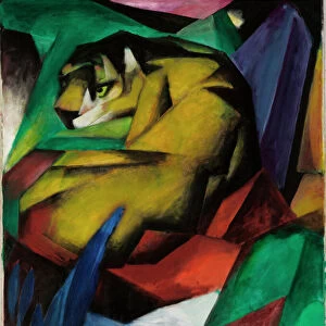
> Animals
> Mammals
> Cats (Wild)
> Tiger
> Animals
> Mammals
> Muridae
> Water Mouse
> Arts
> Contemporary art
> Digital artwork
> Street art
> Arts
> Landscape paintings
> Waterfall and river artworks
> River artworks
> Arts
> Portraits
> Pop art gallery
> Street art portraits
> Arts
> Street art graffiti
> Digital art
> Digital paintings
> Europe
> United Kingdom
> England
> Middlesex
> Related Images
> Fine Art Storehouse
> Map
> Reference Maps
> Maps and Charts
> Related Images
> Popular Themes
> Lake District
EDITORS COMMENTS
This print showcases the MA Middlesex Wayland Vector Road Map, a stunning piece of cartography art. Created by Frank Ramspott, this digitally generated image is a testament to his exceptional design skills and attention to detail. The map features various layers sourced from the public domain, including areawater, linearwater, roads, rails, cousub, pointlm, and uac10. Utilizing vibrant colors and precise vector graphics technology, Ramspott has brought this map to life with incredible accuracy. With no people in sight, the focus remains solely on the intricate details of this Massachusetts county district. The geographical borders are clearly defined while cities like Tower Hill and Weston stand out prominently. Rivers gracefully wind their way through the landscape while lakes shimmer under the sunlight. Every street name is meticulously labeled along with other essential text elements that help navigate through towns such as Saxonville and Cochituate. This road map not only serves as an aesthetically pleasing artwork but also provides practical information for those exploring Middlesex County. Whether you have a passion for geography or simply appreciate visually striking images, this print will undoubtedly captivate your imagination. Hang it on your wall to add a touch of sophistication to any space or gift it to someone who shares your love for maps and digital composites.
MADE IN THE USA
Safe Shipping with 30 Day Money Back Guarantee
FREE PERSONALISATION*
We are proud to offer a range of customisation features including Personalised Captions, Color Filters and Picture Zoom Tools
SECURE PAYMENTS
We happily accept a wide range of payment options so you can pay for the things you need in the way that is most convenient for you
* Options may vary by product and licensing agreement. Zoomed Pictures can be adjusted in the Cart.