Home > North America > United States of America > Arkansas > Fort Smith
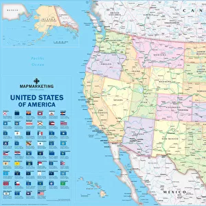
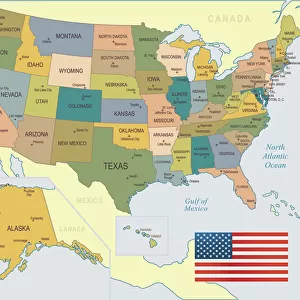
Fort Smith Arkansas US City Street Map

![]()
Wall Art and Photo Gifts from Fine Art Storehouse
Fort Smith Arkansas US City Street Map
Vector Illustration of a City Street Map of Fort Smith, Arkansas, USA. Scale 1:60, 000.
All source data is in the public domain.
U.S. Geological Survey, US Topo
Used Layers:
USGS The National Map: National Hydrography Dataset (NHD)
USGS The National Map: National Transportation Dataset (NTD)
Unleash your creativity and transform your space into a visual masterpiece!
Frank Ramspott
Media ID 15192894
© Frank Ramspott, all rights reserved
Aerial View Arkansas City Map Computer Graphic Directly Above Downtown District Gray Road Map Text Digitally Generated Image Green Color White Color
FEATURES IN THESE COLLECTIONS
> Aerial Photography
> Related Images
> Animals
> Insects
> Butterflies
> Smith Blue
> Animals
> Insects
> Hemiptera
> Green Scale
> Arts
> Landscape paintings
> Waterfall and river artworks
> River artworks
> Arts
> Portraits
> Pop art gallery
> Street art portraits
> Fine Art Storehouse
> Map
> Street Maps
> Fine Art Storehouse
> Map
> USA Maps
> Maps and Charts
> Geological Map
> North America
> United States of America
> Arkansas
> Fort Smith
> North America
> United States of America
> Lakes
> Related Images
> North America
> United States of America
> Maps
EDITORS COMMENTS
This print showcases a meticulously detailed city street map of Fort Smith, Arkansas, USA. With a scale of 1:60,000, every intricate feature is beautifully illustrated in this vector image. The source data used for this artwork is from the public domain and provided by the U. S. Geological Survey's National Map project. The map encompasses various elements that make Fort Smith unique and vibrant. From its downtown district to the serene lake and river, each landmark is accurately represented on this visually stunning piece. The streets are intricately designed with meticulous attention to detail, allowing viewers to navigate through the city effortlessly. Created using computer graphics technology, this digitally generated image offers an aerial view directly above Fort Smith. The color palette includes shades of gray, blue, white, and green which bring life to the physical geography of the area. Frank Ramspott skillfully crafted this masterpiece with precision and expertise. This artwork does not feature any people but focuses solely on showcasing the beauty and layout of Fort Smith's urban landscape. Whether you're a resident or visitor planning your next adventure in Fort Smith or simply appreciate cartography at its finest, this print will undoubtedly captivate your imagination as it seamlessly combines artistry and functionality into one remarkable composition.
MADE IN THE USA
Safe Shipping with 30 Day Money Back Guarantee
FREE PERSONALISATION*
We are proud to offer a range of customisation features including Personalised Captions, Color Filters and Picture Zoom Tools
SECURE PAYMENTS
We happily accept a wide range of payment options so you can pay for the things you need in the way that is most convenient for you
* Options may vary by product and licensing agreement. Zoomed Pictures can be adjusted in the Cart.