Home > Arts > Landscape paintings > Waterfall and river artworks > River artworks
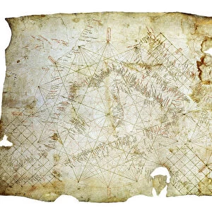
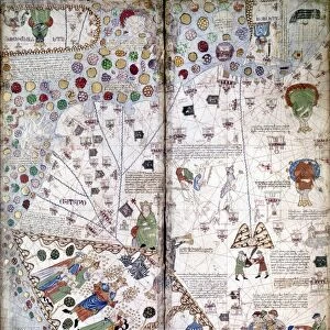
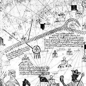
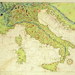
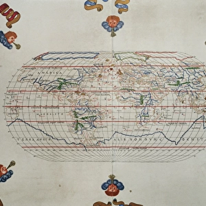
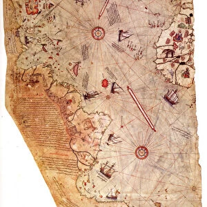
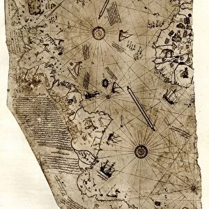
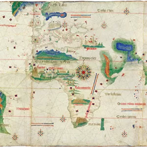
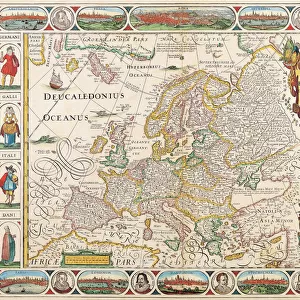
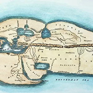
CANTINO WORLD MAP, 1502. The Cantino chart of 1502, the earliest Portugese manuscript

![]()
Wall Art and Photo Gifts from Granger
CANTINO WORLD MAP, 1502. The Cantino chart of 1502, the earliest Portugese manuscript
CANTINO WORLD MAP, 1502.
The Cantino chart of 1502, the earliest Portugese manuscript showing New World discoveries
Granger holds millions of images spanning more than 25,000 years of world history, from before the Stone Age to the dawn of the Space Age
Media ID 12319646
1502 Age Of Discovery New World Portolan Chart Portuguese South America World Planisphere
FEATURES IN THESE COLLECTIONS
> Arts
> Landscape paintings
> Waterfall and river artworks
> River artworks
> Granger Art on Demand
> Maps
> Maps and Charts
> World
> South America
> Related Images
EDITORS COMMENTS
This print showcases the Cantino World Map of 1502, a significant piece of early Portuguese manuscript that unveils the discoveries made in the New World. Created during the Age of Discovery, this remarkable map offers a glimpse into the Renaissance period and its thirst for exploration and knowledge. The Cantino chart stands as one of the earliest surviving Portuguese manuscripts depicting these groundbreaking discoveries. Its intricate details and precise cartography provide an invaluable historical record of South America and other parts of the world as known at that time. As we delve into this mesmerizing planisphere, we are transported back to an era when brave explorers embarked on perilous journeys across uncharted waters. The map reveals rivers winding through vast landscapes, hinting at untamed territories waiting to be explored further. This extraordinary portolan chart not only serves as a testament to human curiosity but also represents Portugal's pivotal role in shaping our understanding of geography during this transformative period. It is a testament to mankind's relentless pursuit of knowledge and expansion. Displayed within Granger Art on Demand's Carousel Collection, this print allows us to appreciate both the artistic beauty and historical significance encapsulated within this ancient document. As we gaze upon it, let us marvel at how far we have come since those early days while acknowledging our debt to those intrepid explorers who paved the way for future generations.
MADE IN THE USA
Safe Shipping with 30 Day Money Back Guarantee
FREE PERSONALISATION*
We are proud to offer a range of customisation features including Personalised Captions, Color Filters and Picture Zoom Tools
SECURE PAYMENTS
We happily accept a wide range of payment options so you can pay for the things you need in the way that is most convenient for you
* Options may vary by product and licensing agreement. Zoomed Pictures can be adjusted in the Cart.