Home > Europe > Luxembourg > Maps
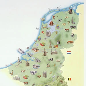
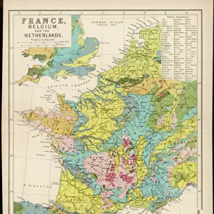
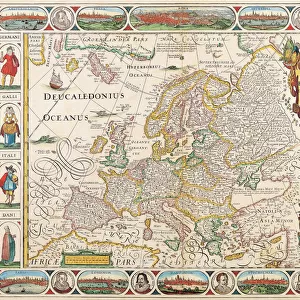
1710, De La Feuille Map of the Netherlands, Belgium and Luxembourg, topography, cartography

![]()
Wall Art and Photo Gifts from Liszt Collection
1710, De La Feuille Map of the Netherlands, Belgium and Luxembourg, topography, cartography
1710, De La Feuille Map of the Netherlands, Belgium and Luxembourg
Liszt Collection of nineteenth-century engravings and images to browse and enjoy
Media ID 14004476
© Artokoloro Quint Lox Limited
1710 Antique Map Atlas Chart Geographic Latitude Longitude Mappa Mundi Old Antique Plan Old Antique View Old Map Ols Antique Map Rare Old Maps Topo
FEATURES IN THESE COLLECTIONS
> Europe
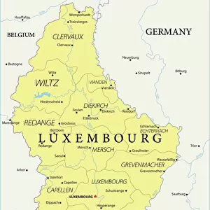
> Luxembourg
> Maps
> Europe
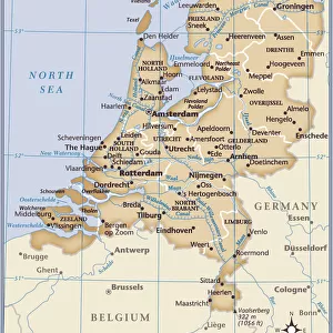
> Netherlands
> Maps
> Maps and Charts
> Early Maps
> Maps and Charts
> Luxembourg
> Maps and Charts
> Netherlands
> Maps and Charts
> World
EDITORS COMMENTS
This print showcases a remarkable piece of history - the 1710 De La Feuille Map of the Netherlands, Belgium, and Luxembourg. With its intricate topography and detailed cartography, this map offers a fascinating glimpse into the past. The artistry and precision displayed in this vintage illustration make it an exquisite addition to any collection. As we explore this ancient map, we are transported back in time to an era when travel and navigation were vastly different from what they are today. The grid lines depicting latitude and longitude provide a sense of order amidst the vastness of these regions. Each geometric shape represents a unique landform or geographic feature, inviting us to embark on a journey of discovery. The aged appearance adds charm and authenticity to this historical artifact. Its weathered edges tell tales of countless hands that have held it over centuries gone by. This rare old map serves as both a window into our past and a testament to human curiosity about the world around us. Whether you are an avid collector or simply appreciate the beauty of antique maps, this De La Feuille creation is sure to captivate your imagination. Let its rich history transport you through time as you marvel at its intricate details and contemplate the journeys taken by those who relied on such maps for exploration centuries ago.
MADE IN THE USA
Safe Shipping with 30 Day Money Back Guarantee
FREE PERSONALISATION*
We are proud to offer a range of customisation features including Personalised Captions, Color Filters and Picture Zoom Tools
SECURE PAYMENTS
We happily accept a wide range of payment options so you can pay for the things you need in the way that is most convenient for you
* Options may vary by product and licensing agreement. Zoomed Pictures can be adjusted in the Cart.