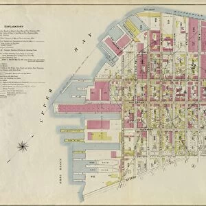
Brooklyn, Vol. 3, Double Page Plate No. 9;Part of Wards 14 & 17, Sections 8 & 9

![]()
Wall Art and Photo Gifts from Liszt Collection
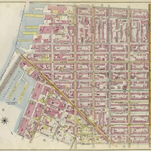
Brooklyn, Vol. 3, Double Page Plate No. 9;Part of Wards 14 & 17, Sections 8 & 9
Brooklyn, Vol. 3, Double Page Plate No. 9; Part of Wards 14 & 17, Sections 8 & 9; Map bounded by North Fourteenth St. Driggs Ave. North Fifth St. Including East River, Bushwick Greek
Liszt Collection of nineteenth-century engravings and images to browse and enjoy
Media ID 12673471
© Quint Lox Limited
Brooklyn Cartographic Double Page Historic Map Map Bounded By Plate No 9 Vintage Map Vol 3
MADE IN THE USA
Safe Shipping with 30 Day Money Back Guarantee
FREE PERSONALISATION*
We are proud to offer a range of customisation features including Personalised Captions, Color Filters and Picture Zoom Tools
SECURE PAYMENTS
We happily accept a wide range of payment options so you can pay for the things you need in the way that is most convenient for you
* Options may vary by product and licensing agreement. Zoomed Pictures can be adjusted in the Cart.