Home > Europe > United Kingdom > England > London > Boroughs > Hounslow
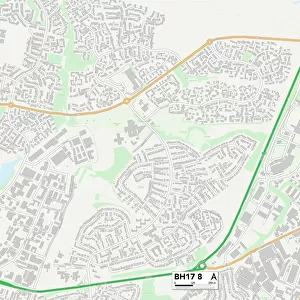
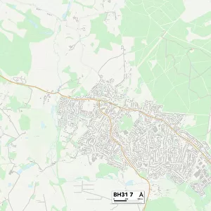
Poole BH15 4 Map

![]()
Wall Art and Photo Gifts from Map Marketing
Poole BH15 4 Map
Postcode Sector Map of Poole BH15 4
Media ID 19965530
Adams Close Ashmore Avenue Blandford Close Blandford Road Carisbrooke Crescent Carmel Close Caversham Close Centurion Close Dean Close Eccles Road Ferry Road Galloway Road Ham Hill Hamilton Close Hamilton Crescent Hamilton Road Hercules Road Ivor Road Lake Lake Avenue Lake Drive Lake Road Lanark Close Legion Close Lucas Road Lulworth Avenue Lulworth Close Manton Close Manton Road Napier Road Normandy Way Old School Place Poole Rockley Road Saxon Close St Michaels Close Station Road Stone Close Woodlands Avenue Woodlands Crescent Lake Crescent
FEATURES IN THESE COLLECTIONS
> Arts
> Artists
> J
> Jacob Jacobs
> Arts
> Artists
> S
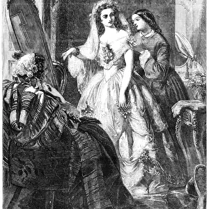
> Abraham Solomon
> Arts
> Artists
> W
> Benjamin West
> Europe
> Italy
> Campania
> Salerno
> Europe
> United Kingdom
> England
> Cumberland
> Europe
> United Kingdom
> England
> London
> Boroughs
> Hounslow
> Europe
> United Kingdom
> Heritage Sites
> New Lanark
> Europe
> United Kingdom
> Scotland
> Dumfries and Galloway
> Related Images
> Europe
> United Kingdom
> Scotland
> Strathclyde
> Hamilton
> Europe
> United Kingdom
> Scotland
> Strathclyde
> Lanark
> Map Marketing
> Postcode Sector Maps
> BH - Bournemouth
MADE IN THE USA
Safe Shipping with 30 Day Money Back Guarantee
FREE PERSONALISATION*
We are proud to offer a range of customisation features including Personalised Captions, Color Filters and Picture Zoom Tools
SECURE PAYMENTS
We happily accept a wide range of payment options so you can pay for the things you need in the way that is most convenient for you
* Options may vary by product and licensing agreement. Zoomed Pictures can be adjusted in the Cart.