Home > Architecture > Tunnels
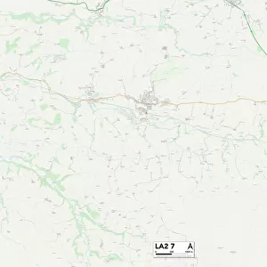
Lancaster LA7 7 Map

![]()
Wall Art and Photo Gifts from Map Marketing
Lancaster LA7 7 Map
Postcode Sector Map of Lancaster LA7 7
Media ID 19973504
Back Lane Beech Close Birks Lane Chapel Close Chestnut Way Church Street Deepdale Close Firs Close Firs Road Green Lane Greenbank Avenue Hill Top Hillcrest Hillcrest Drive Holly Close Kirkgate Lancaster Leighton Close Leighton Drive Main Street Marsh Road Mill Lane Milton Milton Lane Moor Lane Moss Lane Paddock Way Paradise Lane Park House Drive Park Road Pipers Close Princes Way Shaw Lane St Anthonys Close Stanley Street Sycamore Grove Tarn Close The Ashes The Orchard The Pasture The Square The Willows Tunnel Lane Watery Lane White Lane Woodhouse Lane Woodlands Close Beetham Hale Milnthorpe Rowell
FEATURES IN THESE COLLECTIONS
> Architecture
> Tunnels
> Map Marketing
> Postcode Sector Maps
> LA - Lancaster
> Maps and Charts
> Related Images
MADE IN THE USA
Safe Shipping with 30 Day Money Back Guarantee
FREE PERSONALISATION*
We are proud to offer a range of customisation features including Personalised Captions, Color Filters and Picture Zoom Tools
SECURE PAYMENTS
We happily accept a wide range of payment options so you can pay for the things you need in the way that is most convenient for you
* Options may vary by product and licensing agreement. Zoomed Pictures can be adjusted in the Cart.