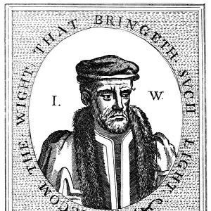
Home > Arts > Portraits > Pop art gallery > Street art portraits
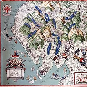
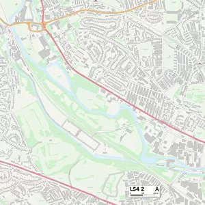
Leeds LS17 9 Map

![]()
Wall Art and Photo Gifts from Map Marketing
Leeds LS17 9 Map
Postcode Sector Map of Leeds LS17 9
Media ID 19973747
Bondgate Castle Close Castle Grove Church Drive Church Lane Coal Road Cornmill Close Crabtree Lane First Avenue Forge Lane Grange Close Harewood Avenue Harewood Road Harrogate Road Laurel Close Leeds Leeds Road Linden Close Main Street Maple Gardens Margaret Avenue Meadow Close Meadow Croft Mill Lane Moor End Moor Lane Old Road Otley Road Paddock View Sandy Gate School Lane Second Avenue Smithy Lane South Bank Spring Gardens The Avenue The Close The Dell The Drive The Grove The Paddock Tithe Barn Lane Wetherby Road Whitegate Wood Lane Harewood
FEATURES IN THESE COLLECTIONS
> Animals
> Mammals
> Muridae
> House Mouse
> Arts
> Portraits
> Pop art gallery
> Street art portraits
> Map Marketing
> Postcode Sector Maps
> LS - Leeds
> Maps and Charts
> Related Images
MADE IN THE USA
Safe Shipping with 30 Day Money Back Guarantee
FREE PERSONALISATION*
We are proud to offer a range of customisation features including Personalised Captions, Color Filters and Picture Zoom Tools
SECURE PAYMENTS
We happily accept a wide range of payment options so you can pay for the things you need in the way that is most convenient for you
* Options may vary by product and licensing agreement. Zoomed Pictures can be adjusted in the Cart.