Home > Europe > United Kingdom > England > Derbyshire > Tideswell
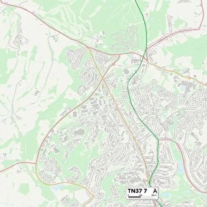
Derbyshire Dales S32 5 Map

![]()
Wall Art and Photo Gifts from Map Marketing
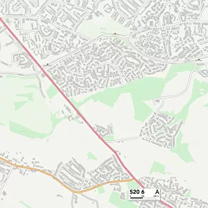
Derbyshire Dales S32 5 Map
Postcode Sector Map of Derbyshire Dales S32 5
Media ID 19978904
Bradshaw Lane Church Street Derbyshire Dales Glebe Park Lydgate Mill Lane New Close New Road The Causeway The Square Townhead Water Lane Windmill Lane Bretton Eyam
FEATURES IN THESE COLLECTIONS
> Europe
> United Kingdom
> England
> Derbyshire
> New Mills
> Europe
> United Kingdom
> England
> Derbyshire
> Related Images
> Europe
> United Kingdom
> England
> Derbyshire
> Tideswell
> Map Marketing
> Postcode Sector Maps
> S - Sheffield
MADE IN THE USA
Safe Shipping with 30 Day Money Back Guarantee
FREE PERSONALISATION*
We are proud to offer a range of customisation features including Personalised Captions, Color Filters and Picture Zoom Tools
SECURE PAYMENTS
We happily accept a wide range of payment options so you can pay for the things you need in the way that is most convenient for you
* Options may vary by product and licensing agreement. Zoomed Pictures can be adjusted in the Cart.