Home > Europe > United Kingdom > England > London > Politics > Edward Heath
Neath Port Talbot SA11 5 Map

![]()
Wall Art and Photo Gifts from Map Marketing
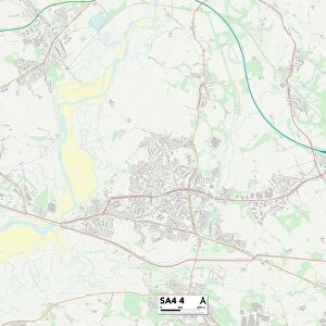
Neath Port Talbot SA11 5 Map
Postcode Sector Map of Neath Port Talbot SA11 5
Media ID 19977758
A465 Aberdare Road Avon Street Bethel Road Brodawel Brynhyfryd Cedar Street Church Crescent Dinas Road Dunraven Street Edward Street Freshfields Heathfield Avenue Heol Y Felin Heol Y Graig High Street Lancaster Close Llewellyn Street Maes Yr Eglwys Manor Drive Merthyr Road Neath Port Talbot New Street Parish Road Park Avenue Riverside Gardens Robert Street Roberts Close Rock Street School Street St Marys Close Vale View Whitefield Close Woodland Park Pontneddfechan
FEATURES IN THESE COLLECTIONS
> Animals
> Mammals
> Muridae
> Heath Mouse
> Arts
> Artists
> C
> Craig Craig
> Arts
> Artists
> E
> Edward Edwards
> Europe
> United Kingdom
> England
> Avon
> Europe
> United Kingdom
> England
> London
> Politics
> Edward Heath
> Europe
> United Kingdom
> Wales
> Mid Glamorgan
> Aberdare
> Europe
> United Kingdom
> Wales
> West Glamorgan
> Neath
> Europe
> United Kingdom
> Wales
> West Glamorgan
> Port Talbot
> Map Marketing
> Postcode Sector Maps
> SA - Swansea
MADE IN THE USA
Safe Shipping with 30 Day Money Back Guarantee
FREE PERSONALISATION*
We are proud to offer a range of customisation features including Personalised Captions, Color Filters and Picture Zoom Tools
SECURE PAYMENTS
We happily accept a wide range of payment options so you can pay for the things you need in the way that is most convenient for you
* Options may vary by product and licensing agreement. Zoomed Pictures can be adjusted in the Cart.