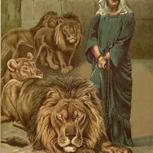
Home > Animals > Mammals > Muridae > Peters Mouse
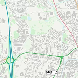
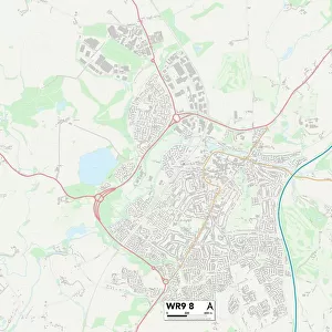
Worcester WR8 9 Map

![]()
Wall Art and Photo Gifts from Map Marketing
Worcester WR8 9 Map
Postcode Sector Map of Worcester WR8 9
Media ID 19982722
Birch Green Birch Lane Bluebell Lane Bourne Road Church Close Church Lane Church Road Clifton Court Road Crown Court Crown Lane Ham Lane High Green Hill Road Hill View Hill View Road Ladywood Road Lodge Hill Main Street Meadow Close Mill Lane Orchard Close Quay Lane Salters Lane Sandford Spring Bank St Peters Lane Station Road The Acre The Granary The Lane Upper Street Westfield Lane Woodmancote Worcester Worcester Road Kinnersley Pirton
FEATURES IN THESE COLLECTIONS
> Animals
> Mammals
> Muridae
> Peters Mouse
> Map Marketing
> Postcode Sector Maps
> WR - Worcester
> Maps and Charts
> Related Images
MADE IN THE USA
Safe Shipping with 30 Day Money Back Guarantee
FREE PERSONALISATION*
We are proud to offer a range of customisation features including Personalised Captions, Color Filters and Picture Zoom Tools
SECURE PAYMENTS
We happily accept a wide range of payment options so you can pay for the things you need in the way that is most convenient for you
* Options may vary by product and licensing agreement. Zoomed Pictures can be adjusted in the Cart.