Home > Universal Images Group (UIG) > Art > Painting, Sculpture & Prints > Cartography
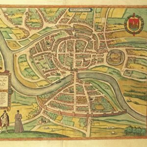
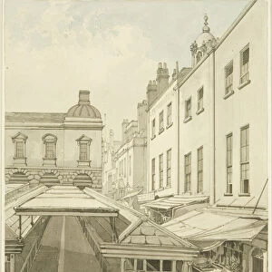
Map of Bristol, Great Britain and its surroundings, 1671

![]()
Wall Art and Photo Gifts from Universal Images Group (UIG)
Map of Bristol, Great Britain and its surroundings, 1671
Cartography, Great Britain, 17th century. Map of Bristol and its surroundings, 1671
Universal Images Group (UIG) manages distribution for many leading specialist agencies worldwide
Media ID 9501867
© DEA / A. C. COOPER
17th Century Bristol City Coat Of Arms English Culture Guidance Handwriting River
EDITORS COMMENTS
This print showcases a remarkable piece of history, the "Map of Bristol, Great Britain and its surroundings, 1671". Transporting us back to the 17th century, this cartographic masterpiece provides an invaluable glimpse into the past. The meticulously detailed map captures the essence of Bristol, UK, during that era with its intricate illustrations and paintings. The city's coat of arms proudly adorns this studio-shot print, symbolizing Bristol's rich heritage and significance. With its horizontal layout and expertly crafted handwriting, this map serves as a reliable guide for exploring England's cultural gem. It offers a comprehensive view of Bristol's river network while skillfully omitting any human presence. As we delve into this historical artifact from Universal Images Group (UIG), we are transported to an era where cartography was both artistry and science. This illustration not only represents English culture but also highlights the importance placed on mapping in understanding geographical landscapes. With no mention of commercial use intended for this photograph print, it allows us to appreciate it solely for its historical value. Whether you're a history enthusiast or simply intrigued by maps as windows into the past, this image is sure to captivate your imagination. Step back in time with this stunning visual representation of Bristol in 1671 – a true testament to our ever-evolving world.
MADE IN THE USA
Safe Shipping with 30 Day Money Back Guarantee
FREE PERSONALISATION*
We are proud to offer a range of customisation features including Personalised Captions, Color Filters and Picture Zoom Tools
SECURE PAYMENTS
We happily accept a wide range of payment options so you can pay for the things you need in the way that is most convenient for you
* Options may vary by product and licensing agreement. Zoomed Pictures can be adjusted in the Cart.