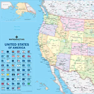
Home > North America > United States of America > Maps
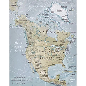
Physical Map Of North America In The Late 19Th Century

![]()
Wall Art and Photo Gifts from Universal Images Group (UIG)
Physical Map Of North America In The Late 19Th Century
Universal Images Group (UIG) manages distribution for many leading specialist agencies worldwide
Media ID 20165231
© Universal Images Group
America American Century Country Late Mapmaking Nineteenth North Physical States United
FEATURES IN THESE COLLECTIONS
> Maps and Charts
> Related Images
> North America
> Related Images
> North America
> United States of America
> Maps
> Universal Images Group (UIG)
> History
> Historical Maps
EDITORS COMMENTS
This print showcases a remarkable piece of cartographic history - the Physical Map of North America in the late 19th century. As we delve into this intricately detailed illustration, we are transported back to an era where mapmaking was both an art form and a scientific endeavor. The map itself is a testament to the skill and dedication of its creators, capturing not only the geographical features but also providing insight into the political landscape of that time. The United States, still expanding westward during this period, takes center stage with its vast territories and emerging states. Surrounding it, we see Canada's sprawling wilderness stretching towards Alaska's rugged coastline. Every contour line and shading on this physical map tells a story about North America's diverse landscapes - from the majestic Rocky Mountains cutting through western regions to the Great Plains extending across central areas. Rivers meander gracefully across their designated paths while lakes shimmer like precious gems amidst lush forests. As our eyes wander over each meticulously drawn detail, we can't help but marvel at how far our understanding of geography has come since then. This image serves as a reminder of how maps have played an essential role in shaping our perception of continents and countries throughout history. Thanks to Universal History Archive for preserving such valuable historical artifacts like this Physical Map of North America in the late 19th century – allowing us to appreciate not only its artistic beauty but also gain insights into past civilizations' knowledge and exploration efforts.
MADE IN THE USA
Safe Shipping with 30 Day Money Back Guarantee
FREE PERSONALISATION*
We are proud to offer a range of customisation features including Personalised Captions, Color Filters and Picture Zoom Tools
SECURE PAYMENTS
We happily accept a wide range of payment options so you can pay for the things you need in the way that is most convenient for you
* Options may vary by product and licensing agreement. Zoomed Pictures can be adjusted in the Cart.