Home > Africa > Uganda > Maps
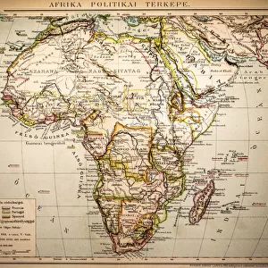
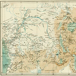
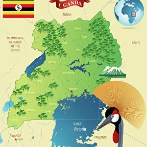
Map Of Central Africa Circa 1930. From The Modern Atlas Of The World Published Circa 1930

![]()
Wall Art and Photo Gifts from Design Pics
Map Of Central Africa Circa 1930. From The Modern Atlas Of The World Published Circa 1930
Design Pics offers Distinctively Different Imagery representing over 1,500 contributors
Media ID 18193042
© Ken Welsh / Design Pics
Abyssinia Africa Belgian Central Colonies Congo Italian Kenya Madagascar Maps Northern South Southern Tanganyika Transvaal Uganda Wars West World Angola Bechuanaland Equatorial Possessions Protectorate Protectorates Rhodesia Somaliland
FEATURES IN THESE COLLECTIONS
> Africa
> Angola
> Related Images
> Africa
> Kenya
> Related Images
> Africa
> Madagascar
> Maps
> Africa
> Madagascar
> Related Images
> Africa
> South Africa
> Maps
> Africa
> South Africa
> Related Images
> Africa
> Uganda
> Related Images
EDITORS COMMENTS
This print showcases a Map of Central Africa circa 1930, taken from The Modern Atlas of the World published around the same time. The map provides a fascinating glimpse into the geopolitical landscape of this region during that era. The intricate details on the map highlight various European possessions and colonies in Central Africa, including French territories, Italian colonies, Belgian Equatorial regions, and British protectorates such as Uganda and Kenya. It also features prominent African countries like Angola, Abyssinia (modern-day Ethiopia), Madagascar, Congo, Tanganyika (now part of Tanzania), Rhodesia (present-day Zimbabwe), Bechuanaland (Botswana), and Somaliland. The historical significance of this map lies in its depiction of power struggles between European nations for control over African territories. It reflects an era marked by colonialism and conflicts as these powers sought to expand their influence across the continent. Ken Welsh's expertly captured print allows us to appreciate both the artistic beauty and historical value embedded within this vintage map. Whether you are a history enthusiast or simply intrigued by cartography, this piece serves as a window into Central Africa's past while reminding us how far we have come since then.
MADE IN THE USA
Safe Shipping with 30 Day Money Back Guarantee
FREE PERSONALISATION*
We are proud to offer a range of customisation features including Personalised Captions, Color Filters and Picture Zoom Tools
SECURE PAYMENTS
We happily accept a wide range of payment options so you can pay for the things you need in the way that is most convenient for you
* Options may vary by product and licensing agreement. Zoomed Pictures can be adjusted in the Cart.