Home > Europe > United Kingdom > England > London > Boroughs > Havering
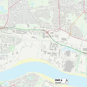
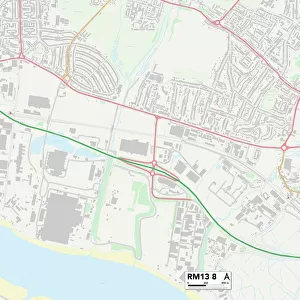
Havering RM13 7 Map

![]()
Wall Art and Photo Gifts from Map Marketing
Havering RM13 7 Map
Postcode Sector Map of Havering RM13 7
Media ID 19979640
Alexandra Road Beaumont Crescent Blacksmiths Lane Castle Avenue Cherry Tree Close Cherry Walk Conway Close Dawson Drive Ford Close Ford Lane Fyfield Road Gainsborough Road Grove Park Road Harlow Road Havering Hayes Drive Jersey Road Monarch Close Oliver Road Park Mews Portway Simpson Road St Johns Close St Matthews Close Stanhope Road Sunningdale Road Victory Road Willoughby Drive York Road Princes Park Stephen Avenue
FEATURES IN THESE COLLECTIONS
> Animals
> Birds
> Flamingos
> Related Images
> Arts
> Artists
> F
> John Ford
> Arts
> Artists
> S
> John Simpson
> Europe
> United Kingdom
> England
> London
> Boroughs
> Havering
> Map Marketing
> Postcode Sector Maps
> RM - Romford
> Maps and Charts
> Related Images
MADE IN THE USA
Safe Shipping with 30 Day Money Back Guarantee
FREE PERSONALISATION*
We are proud to offer a range of customisation features including Personalised Captions, Color Filters and Picture Zoom Tools
SECURE PAYMENTS
We happily accept a wide range of payment options so you can pay for the things you need in the way that is most convenient for you
* Options may vary by product and licensing agreement. Zoomed Pictures can be adjusted in the Cart.