Fraud Blocker Skip to main content

Home > Europe > United Kingdom > England > Maps

London Map - Roman Period

London Map - Roman Period


Photo Prints
Jigsaw Puzzles
Poster Prints
Canvas Prints
Fine Art Prints
Metal Prints
Home Decor


We accept all major credit cards

Mary Evans Prints Online

Wall Art and Photo Gifts from Mary Evans Picture Library

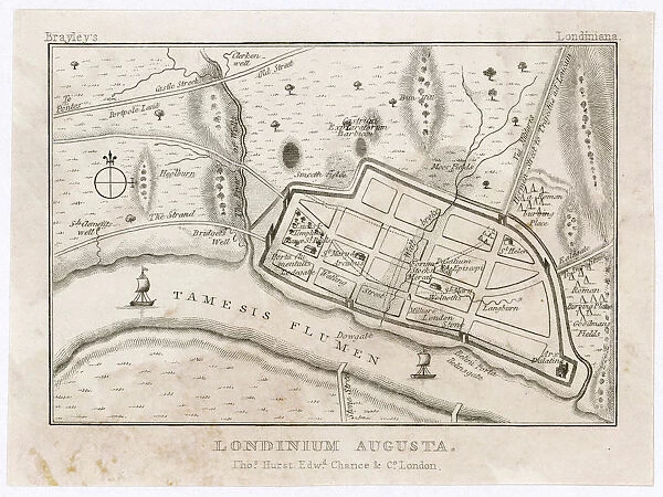
London Map - Roman Period

Map showing Roman London (Londinium) with its grid of straight roads

Mary Evans Picture Library makes available wonderful images created for people to enjoy over the centuries

Media ID 20147145

© Bubblepunk

Grid Maps Roads Straight Londinium


FEATURES IN THESE COLLECTIONS

> Arts > Artists > R > Roman Roman

> Europe > United Kingdom > England > London > Related Images

> Europe > United Kingdom > England > Maps

> Europe > United Kingdom > England > Posters

> Europe > United Kingdom > England > Related Images

> Maps and Charts > Related Images

> Mary Evans Prints Online > London

> Mary Evans Prints Online > New Images July 2020


MADE IN THE USA
Safe Shipping with 30 Day Money Back Guarantee

FREE PERSONALISATION*
We are proud to offer a range of customisation features including Personalised Captions, Color Filters and Picture Zoom Tools

SECURE PAYMENTS
We happily accept a wide range of payment options so you can pay for the things you need in the way that is most convenient for you

* Options may vary by product and licensing agreement. Zoomed Pictures can be adjusted in the Cart.

redeem
Beautiful Photo Prints and Gifts
image
Professionally Printed
inventory
Photo Prints are in stock
thumb_up
Professional quality finish
diamond
Made with high-grade materials
inventory_2
Carefully packed to aid safe arrival


Related Images


Bomb damage, London 1941 BL5947
A heavy horse pulls a light plough
Blitz in London -- ladders and rubble, WW2
Blitz in City of London -- scene in Old Street, WW2
Illustration by Cecil Aldin, dogs eager for a walk
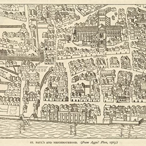
Map of St Pauls and area
Hyde park turnpike
Hyde park turnpike
CRACKER ADVERTISEMENT
Plan of London around St. Pauls in 1563. After Ralph Agass map
Brian Park (Norton) 1962 Senior Manx Grand Prix
Fires in Ave Maria Lane, London, started by high explosive

+

Shipping

+

Choices

+

Reviews

+

Guaranteed


Related Collections


England Related Images
Browse 46,732 Prints
Roman Roman
Roman Roman
Browse 36,708 Prints
Maps and Charts Related Images
Browse 46,659 Prints
London Related Images
Browse 47,003 Prints
New Images July 2020
Browse 10,413 Prints
London
London
Browse 1,652 Prints
Maps
Maps
Browse 9,933 Prints
Posters
Posters
Browse 44,542 Prints