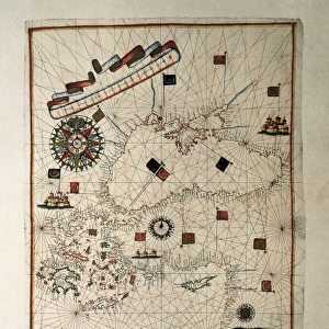
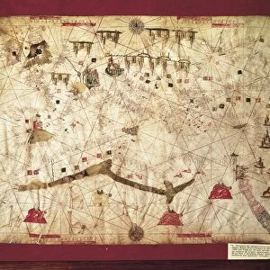
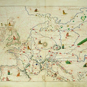
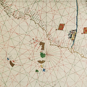
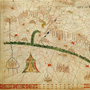
Portolan chart, 16th c. Map of the Eastern Mediterranean

![]()
Wall Art and Photo Gifts from Mary Evans Picture Library
Portolan chart, 16th c. Map of the Eastern Mediterranean
Portolan chart, 16th c. Map of the Eastern Mediterranean Sea and the Black sea. (Anonymous, it is believed to be made by Joan Martines or by his workshop). Renaissance art. Miniature Painting. SPAIN. Barcelona. Barcelona Maritime Museum
Mary Evans Picture Library makes available wonderful images created for people to enjoy over the centuries
Media ID 8276067
© Mary Evans Picture Library 2015 - https://copyrighthub.org/s0/hub1/creation/maryevans/MaryEvansPictureID/10683508
Anonymous Barcelona Believed Chart Joan Martines Mediterranean Portolan Renaissance Workshop Made
MADE IN THE USA
Safe Shipping with 30 Day Money Back Guarantee
FREE PERSONALISATION*
We are proud to offer a range of customisation features including Personalised Captions, Color Filters and Picture Zoom Tools
SECURE PAYMENTS
We happily accept a wide range of payment options so you can pay for the things you need in the way that is most convenient for you
* Options may vary by product and licensing agreement. Zoomed Pictures can be adjusted in the Cart.