Home > Arts > Artists > E > William Elliott
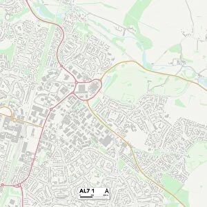
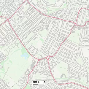
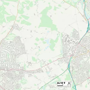
Welwyn Hatfield AL7 4 Map

![]()
Wall Art and Photo Gifts from Map Marketing
Welwyn Hatfield AL7 4 Map
Postcode Sector Map of Welwyn Hatfield AL7 4
Media ID 19965838
Albert Place Bartlett Close Beehive Lane Bennett Close Boundary Lane East Mead Elliott Close Four Acres Green Acres Gypsy Lane Hall Grove Henry Close Hillside Hollybush Lane Hunters Way Kingsley Court Marley Road Meadway Middlefield Moorend Moorlands Moorside Mount Way Princes Avenue Queens Avenue Ryelands Southfield The Croft The Limes The Pastures Victoria Close Walnut Court Walnut Grove Welwyn Hatfield William Close Chequers Harebell
FEATURES IN THESE COLLECTIONS
> Animals
> Mammals
> Cricetidae
> Golden Mouse
> Animals
> Mammals
> Muridae
> Plains Mouse
> Arts
> Artists
> B
> John Bird
> Arts
> Artists
> B
> William Henry Bartlett
> Arts
> Artists
> E
> William Elliott
> Map Marketing
> Postcode Sector Maps
> AL - St Albans
> Maps and Charts
> Related Images
MADE IN THE USA
Safe Shipping with 30 Day Money Back Guarantee
FREE PERSONALISATION*
We are proud to offer a range of customisation features including Personalised Captions, Color Filters and Picture Zoom Tools
SECURE PAYMENTS
We happily accept a wide range of payment options so you can pay for the things you need in the way that is most convenient for you
* Options may vary by product and licensing agreement. Zoomed Pictures can be adjusted in the Cart.