Home > Europe > United Kingdom > England > London > Transport > Aviation > Stansted Airport
Darlington DL2 1 Map

![]()
Wall Art and Photo Gifts from Map Marketing
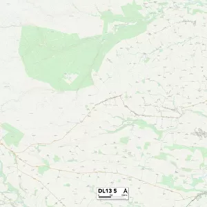
Darlington DL2 1 Map
Postcode Sector Map of Darlington DL2 1
Media ID 19968426
Abbey Road Acorn Close Archer Road Ashdale Close Beacon Hill Burma Road Castle Close Cedar Grove Chapel Street Church Close Church Lane Dale Road Darlington Darlington Road East Close East View Elm Gardens Fairfax Road Goodwood Close Heathfield Park Hill House Lane Hill Rise Middleton Lane Middleton Road Mill Lane Mount Pleasant Close New Lane Norton Crescent Norton Road Oak Tree Close Roundhill Road St Annes Gardens St Margarets Close Station Road Station Terrace Stockton Road The Beeches The Close The Crescent The Greenway The Meadows The Oaklands The Oaks The Orchard The Paddock The Spinney Vickers Close Washington Avenue Wellington Drive West Row Whitworth Drive Cedarwood Dinsdale Martinsyde Oak Tree Teesside International Airport The Front
FEATURES IN THESE COLLECTIONS
> Arts
> Artists
> B
> George Back
> Arts
> Artists
> V
> Georges Villas
> Arts
> Artists
> W
> George Washington
> Arts
> Artists
> W
> Georges Washington
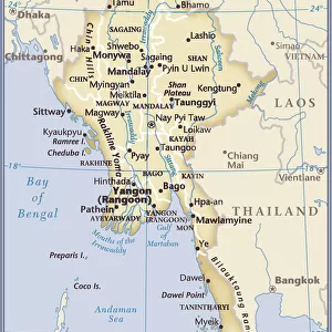
> Asia
> Myanmar
> Related Images
> Europe
> United Kingdom
> England
> London
> Sights
> Heathrow Airport
> Europe
> United Kingdom
> England
> London
> Transport
> Aviation
> Heathrow Airport
> Europe
> United Kingdom
> England
> London
> Transport
> Aviation
> Stansted Airport
> Europe
> United Kingdom
> Scotland
> Fife
> St Andrews
> Map Marketing
> Postcode Sector Maps
> DL - Darlington
MADE IN THE USA
Safe Shipping with 30 Day Money Back Guarantee
FREE PERSONALISATION*
We are proud to offer a range of customisation features including Personalised Captions, Color Filters and Picture Zoom Tools
SECURE PAYMENTS
We happily accept a wide range of payment options so you can pay for the things you need in the way that is most convenient for you
* Options may vary by product and licensing agreement. Zoomed Pictures can be adjusted in the Cart.