Home > Architecture > Tunnels
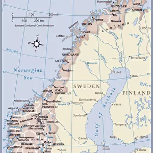
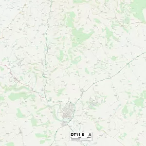
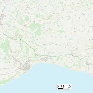
West Dorset DT8 3 Map

![]()
Wall Art and Photo Gifts from Map Marketing
West Dorset DT8 3 Map
Postcode Sector Map of West Dorset DT8 3
Media ID 19969010
Abbot Close Back Lane Baileys Lane Banks Lane Barnes Lane Beech Lane Blind Lane Bridport Road Chantry Lane Chard Road Church Hill Church Path Church Street Clay Lane Common Hill Coombe Lane Crooked Lane Down Road East Street Fairfield Fleet Street Furze Lane Grange Lane Green Lane Hardy Close High Street Holly Lane Holt Lane Manor Close Manor Gardens Meadowside Middle Green Millfield Moor Lane Myrtle Close Newtown North Street Orchard Mead Orchard Way Pound Lane Red Lane Redlands Lane Riverside Rookery Lane School Hill School Lane Sheepwash Lane St James St Marys Gardens Stoke Road Styles Close Tanyard The Beeches The Hayes The Paddocks Tunnel Road Wall Lane Watery Lane West Dorset West Lane West Street Willow Grove Windsor Close Windy Ridge Wood Lane Woods Lane Beaminster Blackdown Brantwood Fullers Hooke Sandpit The Brit
FEATURES IN THESE COLLECTIONS
> Architecture
> Tunnels
> Arts
> Artists
> H
> James Hope
> Arts
> Artists
> W
> James Wood
> Europe
> Norway
> Related Images
> Europe
> United Kingdom
> England
> Dorset
> Beaminster
> Europe
> United Kingdom
> England
> Dorset
> Blackdown
> Europe
> United Kingdom
> England
> Dorset
> Bridport
> Europe
> United Kingdom
> England
> Dorset
> Broadoak
> Map Marketing
> Postcode Sector Maps
> DT - Dorchester
MADE IN THE USA
Safe Shipping with 30 Day Money Back Guarantee
FREE PERSONALISATION*
We are proud to offer a range of customisation features including Personalised Captions, Color Filters and Picture Zoom Tools
SECURE PAYMENTS
We happily accept a wide range of payment options so you can pay for the things you need in the way that is most convenient for you
* Options may vary by product and licensing agreement. Zoomed Pictures can be adjusted in the Cart.