Home > Europe > United Kingdom > England > London > Towns > Oakwood
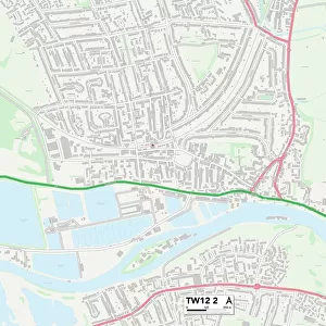
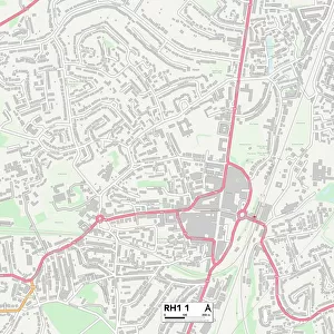
Crawley RH6 7 Map

![]()
Wall Art and Photo Gifts from Map Marketing
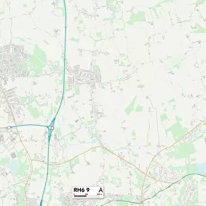
Crawley RH6 7 Map
Postcode Sector Map of Crawley RH6 7
Media ID 19976446
Albert Road Ashleigh Close Brighton Road Burton Close Chequers Close Cheyne Walk Church Road Church Walk Crawley Crescent Way Elizabeth Court Fairfield Avenue Grosvenor Close Hamilton Place High Street Kings Road London Road Longbridge Road Lumley Road Norfolk Close Oakwood Road Oldfield Close Oldfield Road Park View Parkway Queens Road Riverside Southlands Avenue St Hildas Close Suffolk Close The Avenue The Crescent The Dell The Ridgeway Victoria Close Victoria Road Horley
FEATURES IN THESE COLLECTIONS
> Arts
> Artists
> M
> Michael Maier
> Europe
> United Kingdom
> England
> London
> Sights
> Heathrow Airport
> Europe
> United Kingdom
> England
> London
> Sights
> High Court
> Europe
> United Kingdom
> England
> London
> Sights
> Regents Park
> Europe
> United Kingdom
> England
> London
> Sights
> Victoria Park
> Europe
> United Kingdom
> England
> London
> Towns
> Oakwood
> Europe
> United Kingdom
> England
> Norfolk
> Related Images
> Europe
> United Kingdom
> England
> Suffolk
> High Street
> Europe
> United Kingdom
> England
> Suffolk
> Related Images
> Europe
> United Kingdom
> Scotland
> Strathclyde
> Hamilton
> Map Marketing
> Postcode Sector Maps
> RH - Redhill
MADE IN THE USA
Safe Shipping with 30 Day Money Back Guarantee
FREE PERSONALISATION*
We are proud to offer a range of customisation features including Personalised Captions, Color Filters and Picture Zoom Tools
SECURE PAYMENTS
We happily accept a wide range of payment options so you can pay for the things you need in the way that is most convenient for you
* Options may vary by product and licensing agreement. Zoomed Pictures can be adjusted in the Cart.