Home > Africa > Central African Republic > Maps
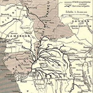
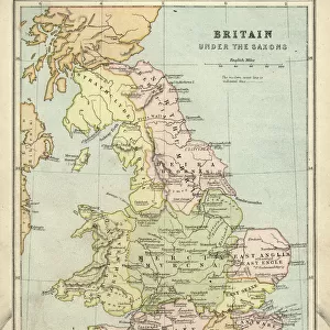
Congo map, central Africa from 1895

![]()
Wall Art and Photo Gifts from Fine Art Storehouse
Congo map, central Africa from 1895
Illustration of a Congo map, central Africa from 1895
Unleash your creativity and transform your space into a visual masterpiece!
Nastasic
Media ID 13750425
© This content is subject to copyright
1890 1899 1895 Atlas Mythological Figure Central Africa Democratic Republic Of The Congo Guinea Morocco Paper Sahara Desert Serbia World Map Equatorial Guinea Republic Of The Congo
FEATURES IN THESE COLLECTIONS
> Africa
> Central African Republic
> Maps
> Africa
> Central African Republic
> Related Images
> Africa
> Democratic Republic of the Congo
> Related Images
> Africa
> Equatorial Guinea
> Maps
> Africa
> Equatorial Guinea
> Related Images
> Africa
> Guinea
> Related Images
> Africa
> Morocco
> Related Images
> Africa
> Related Images
> Fine Art Storehouse
> Map
> Historical Maps
> Fine Art Storehouse
> Travel Imagery
> Travel Destinations
> Morocco, North Africa
> Fine Art Storehouse
> Ultimate Earth Prints
> Amazing Deserts
EDITORS COMMENTS
This print showcases an exquisite illustration of a Congo map from 1895, offering a glimpse into the historical cartography of central Africa. The intricate details and precision engraving transport us back to a time when maps were meticulously crafted by hand. The map encompasses various countries including Serbia, the USA, Equatorial Guinea, Democratic Republic of the Congo, Republic of the Congo, Morocco, and Guinea. It also highlights significant geographical features such as the Sahara Desert. This antique piece serves as a testament to the evolution of physical geography over time. The artist's skillful use of illustration techniques brings this old-world map to life on paper. Every line and contour is delicately etched with care and expertise. As we explore this enchanting artwork, it becomes evident that it not only represents geographic accuracy but also serves as a window into history. Beyond its practical purpose as a navigational tool in its era, this map holds cultural significance too. It reminds us of how our understanding of the world has evolved throughout centuries. Nastasic's remarkable creation captures both artistry and functionality in one frame—a true masterpiece that transports us through time while igniting curiosity about our planet's past exploration and discovery.
MADE IN THE USA
Safe Shipping with 30 Day Money Back Guarantee
FREE PERSONALISATION*
We are proud to offer a range of customisation features including Personalised Captions, Color Filters and Picture Zoom Tools
SECURE PAYMENTS
We happily accept a wide range of payment options so you can pay for the things you need in the way that is most convenient for you
* Options may vary by product and licensing agreement. Zoomed Pictures can be adjusted in the Cart.