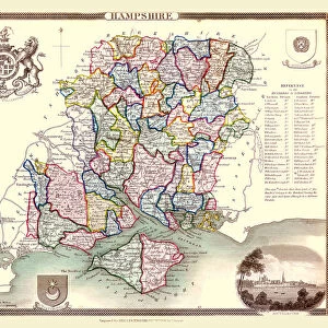
Home > Europe > United Kingdom > England > London > Towns > Welling
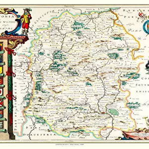
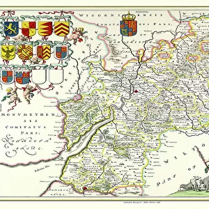
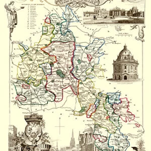
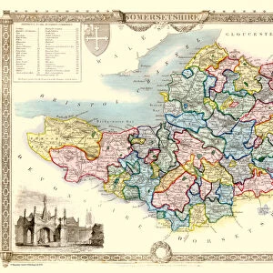
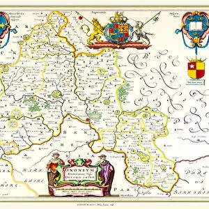
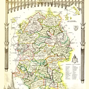
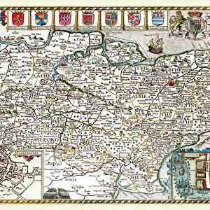
Old County Map of Gloucestershire 1836 by Thomas Moule

![]()
Wall Art and Photo Gifts from MapSeeker
Old County Map of Gloucestershire 1836 by Thomas Moule
This is a fine decorative reproduction County Map of Gloucestershire from the First Edition series of Thomas Moule Maps, originally Published in 1836. The well-known series of County Maps which are known as Moules feature beautiful vignette views and were first published in separate sections for each county in 1830-32, they were then published in collected form in a two-volume work: The English Counties Delineated: or a Topographical Description of England: Illustrated by a Complete Series of County Maps by Thomas Moule: London: Published by George Virtue 1836
Welcome to the Mapseeker Image library and enter an historic gateway to one of the largest on-line collections of Historic Maps, Nostalgic Views, Vista's and Panorama's from a World gone by.
Media ID 20348132
© Mapseeker Publishing Ltd
County Map County Map Of England English County Map Historic Map Moule Map Old County Map Old English County Map Old Moule Map Thomas Moule Thomas Moule Map Gloucestershire
FEATURES IN THESE COLLECTIONS
> Arts
> Artists
> M
> Thomas Moule
> Europe
> United Kingdom
> England
> Gloucestershire
> Related Images
> Europe
> United Kingdom
> England
> London
> Towns
> Welling
> Europe
> United Kingdom
> England
> Maps
> Europe
> United Kingdom
> England
> Wells
> Maps and Charts
> Early Maps
> Maps and Charts
> Related Images
> MapSeeker
> Maps from the British Isles
> England and Counties PORTFOLIO
EDITORS COMMENTS
This stunning print showcases an exquisite reproduction of the "Old County Map of Gloucestershire 1836" by Thomas Moule. Part of his renowned series of County Maps, this particular map is a fine decorative piece that captures the historical charm and beauty of Gloucestershire during the early 19th century. Originally published in separate sections for each county between 1830-32, these maps were later compiled into a two-volume work titled "The English Counties Delineated: or a Topographical Description of England". The complete collection featured intricate vignette views and was published by George Virtue in 1836. Thomas Moule's attention to detail shines through in this old English county map, which offers a fascinating glimpse into Gloucestershire's past. From its rolling hills to its bustling towns and villages, every corner is meticulously depicted with accuracy and artistry. As you explore this historic map, you'll discover not only the geographical features but also gain insight into the cultural heritage and significance of Gloucestershire. Whether you're a history enthusiast or simply appreciate vintage cartography, this print will transport you back in time to an era filled with discovery and exploration. Displaying this remarkable piece on your wall will undoubtedly add character to any space while serving as a reminder of our rich heritage. Let Thomas Moule's masterful craftsmanship take you on an enchanting journey through Gloucestershire's past.
MADE IN THE USA
Safe Shipping with 30 Day Money Back Guarantee
FREE PERSONALISATION*
We are proud to offer a range of customisation features including Personalised Captions, Color Filters and Picture Zoom Tools
SECURE PAYMENTS
We happily accept a wide range of payment options so you can pay for the things you need in the way that is most convenient for you
* Options may vary by product and licensing agreement. Zoomed Pictures can be adjusted in the Cart.