Home > Arts > Artists > S > Antonio Salamanca
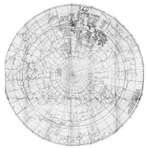
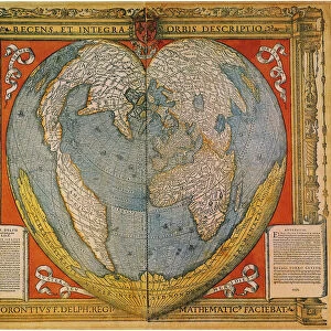
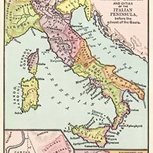
Double cordiform world map by Antonio Salamanca, copperplate, printed in Roma, 1550

![]()
Wall Art and Photo Gifts from Universal Images Group (UIG)
Double cordiform world map by Antonio Salamanca, copperplate, printed in Roma, 1550
Cartography, 16th century. Double cordiform world map by Antonio Salamanca, inspired by Gerardo Mercatore, Roma 1550. Copper print on paper
Universal Images Group (UIG) manages distribution for many leading specialist agencies worldwide
Media ID 9572741
© DEA PICTURE LIBRARY
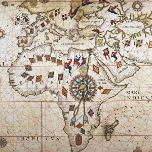
16th Century Africa Antarctic Direction Guidance South America Western Script Antonio Salamanca North Pole South Pole
FEATURES IN THESE COLLECTIONS
> Africa
> Related Images
> Arts
> Artists
> S
> Antonio Salamanca
> Asia
> Related Images
> South America
> Related Images
> Universal Images Group (UIG)
> Art
> Painting, Sculpture & Prints
> Cartography
EDITORS COMMENTS
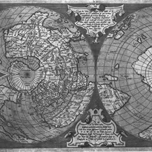
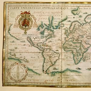
This 16th-century double cordiform world map by Antonio Salamanca takes us on a journey through time and space. Printed in Roma in 1550, this copperplate masterpiece showcases the artistry and precision of cartography during this era. Inspired by Gerardo Mercatore, Salamanca's creation beautifully captures the continents of Africa, Asia, and South America with intricate detail. The horizontal layout allows for a comprehensive view of our planet's physical geography, from the North Pole to the South Pole. As we explore this historical artifact, we are reminded of the importance of maps as guides for travel and navigation. This particular map serves as a testament to human curiosity about distant lands and uncharted territories. The absence of people in this illustration emphasizes its focus on geographical features rather than human activity. Western script labels various regions across the globe while highlighting significant bodies of water like the Atlantic Ocean. Antonio Salamanca's artistic prowess shines through his careful craftsmanship evident in every line etched onto paper using copper print technology. This print is not just an informative tool but also an exquisite work of art that combines both science and aesthetics seamlessly. Step back into history with this remarkable piece that offers glimpses into how our ancestors perceived their world centuries ago. Let your imagination soar as you trace ancient trade routes or ponder over undiscovered lands waiting to be explored.
MADE IN THE USA
Safe Shipping with 30 Day Money Back Guarantee
FREE PERSONALISATION*
We are proud to offer a range of customisation features including Personalised Captions, Color Filters and Picture Zoom Tools
SECURE PAYMENTS
We happily accept a wide range of payment options so you can pay for the things you need in the way that is most convenient for you
* Options may vary by product and licensing agreement. Zoomed Pictures can be adjusted in the Cart.