Home > Europe > Italy > Maps
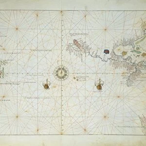
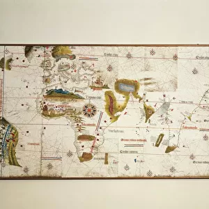
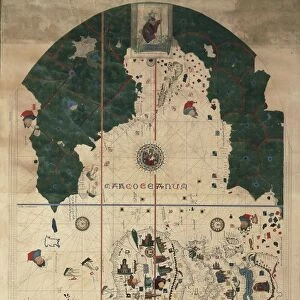
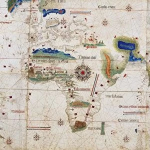
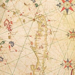
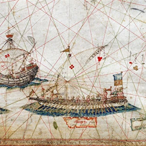
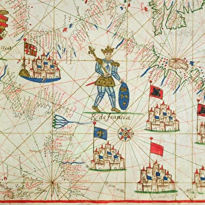
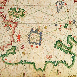
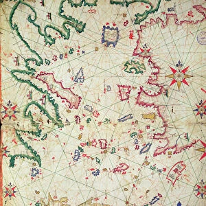
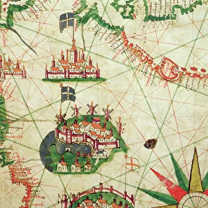
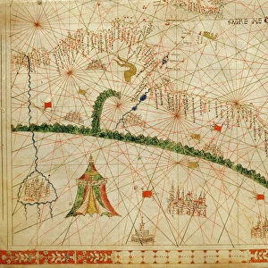
Map attributed to Paolo dal Pozzo Toscanelli, 1397-1482

![]()
Wall Art and Photo Gifts from Universal Images Group (UIG)
Map attributed to Paolo dal Pozzo Toscanelli, 1397-1482
Cartography, Italy, 15th century. Map attributed to Paolo dal Pozzo Toscanelli (1397-1482)
Universal Images Group (UIG) manages distribution for many leading specialist agencies worldwide
Media ID 9570625
© DEA / PINAIDER
15th Century Ellipse Geography
FEATURES IN THESE COLLECTIONS
> Europe
> Italy
> Sculptures
> Universal Images Group (UIG)
> Art
> Painting, Sculpture & Prints
> Cartography
EDITORS COMMENTS
This print showcases a remarkable piece of history - a map attributed to the renowned Italian cartographer, Paolo dal Pozzo Toscanelli. Created in the 15th century, this exquisite work of art offers a glimpse into the world of early cartography and Italy's rich geographical landscape. The map is beautifully presented with its vibrant red hue dominating the horizontal composition. Its intricate details and topographical accuracy are testaments to Toscanelli's expertise in his craft. The elliptical shape adds an element of uniqueness, setting it apart from conventional maps. As we delve into this masterpiece, we are transported back in time, imagining how travelers and explorers relied on such maps for navigation during an era when technology was limited. It serves as a reminder of human curiosity and our innate desire to explore uncharted territories. While devoid of people, this photograph allows us to appreciate the sheer beauty and artistic merit behind Toscanelli's creation. Every stroke and line on this illustration-turned-painting tells a story about Italy's past - its cities, rivers, mountains, and coastlines that have shaped its identity throughout centuries. This print from Universal Images Group (UIG) provides us with an opportunity to admire one man's contribution to cartography while also appreciating the historical significance embedded within this ancient artifact. Let it serve as a visual testament to humanity's quest for knowledge and understanding through artistry.
MADE IN THE USA
Safe Shipping with 30 Day Money Back Guarantee
FREE PERSONALISATION*
We are proud to offer a range of customisation features including Personalised Captions, Color Filters and Picture Zoom Tools
SECURE PAYMENTS
We happily accept a wide range of payment options so you can pay for the things you need in the way that is most convenient for you
* Options may vary by product and licensing agreement. Zoomed Pictures can be adjusted in the Cart.