Home > Africa > Related Images
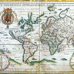
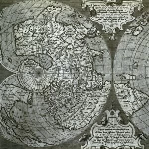
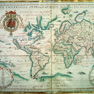
Hydrographic general map by Jean Guerard, 1634

![]()
Wall Art and Photo Gifts from Universal Images Group (UIG)
Hydrographic general map by Jean Guerard, 1634
Cartography, 17th century. Hydrographic general map by Jean Guerard, 1634
Universal Images Group (UIG) manages distribution for many leading specialist agencies worldwide
Media ID 9572529
© DEA PICTURE LIBRARY
Africa Coastline Direction Guidance Indian Ocean Pacific Ocean South America Western Script World Map 1634
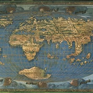
FEATURES IN THESE COLLECTIONS
> Africa
> Related Images
> Asia
> Related Images
> Europe
> Related Images
> North America
> Related Images
> South America
> Related Images
> Universal Images Group (UIG)
> Art
> Painting, Sculpture & Prints
> Cartography
EDITORS COMMENTS
This print showcases a remarkable piece of cartographic history - the Hydrographic general map by Jean Guerard, dating back to 1634. With its intricate details and stunning artistry, this map takes us on a journey through time and space. Stretching horizontally across the frame, this world map offers guidance and direction for travelers of the 17th century. From North America to South America, Africa to Asia, Europe to the vast Pacific and Indian Oceans, every continent is meticulously depicted with precision. The skillful use of Western script allows viewers to decipher the names of various regions and coastlines along these expansive waters. The Atlantic Ocean dominates one side while the other side reveals an awe-inspiring view of distant lands waiting to be explored. As we delve into this historical artifact, we are reminded of how far our understanding of physical geography has come since then. This illustration serves as a testament to human curiosity and exploration in an era when maps were vital tools for discovery. Without any people present in this image, our focus is solely on admiring Guerard's artistic prowess. Each stroke tells a story; each color evokes emotions tied to adventure and wonderment. This print from Universal Images Group (UIG) invites us into a world where travel was both treacherous yet exhilarating - where sea voyages shaped our understanding of continents that lay beyond familiar shores. It reminds us that even centuries later, there is still much beauty in retracing these ancient paths through
MADE IN THE USA
Safe Shipping with 30 Day Money Back Guarantee
FREE PERSONALISATION*
We are proud to offer a range of customisation features including Personalised Captions, Color Filters and Picture Zoom Tools
SECURE PAYMENTS
We happily accept a wide range of payment options so you can pay for the things you need in the way that is most convenient for you
* Options may vary by product and licensing agreement. Zoomed Pictures can be adjusted in the Cart.