Home > Fine Art Storehouse > The Magical World of Illustration > Palmer Illustrated Collection
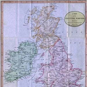
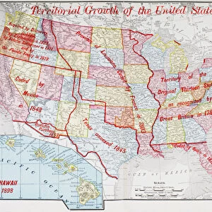
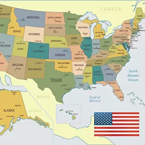
North America geological map 1895

![]()
Wall Art and Photo Gifts from Fine Art Storehouse
North America geological map 1895
Meyers Konversations-Lexikon. Ein Nachschlagewerk des allgemeinen Wissens, 5th edition 17 volumes Bibliographisches Institut - Leipzig 1895-1897
Unleash your creativity and transform your space into a visual masterpiece!
THEPALMER
Media ID 13611779
© This content is subject to copyright
Atlas Mythological Figure Canada Mexico North America Paper World Map
FEATURES IN THESE COLLECTIONS
> Fine Art Storehouse
> The Magical World of Illustration
> Palmer Illustrated Collection
> Fine Art Storehouse
> Map
> Historical Maps
> Fine Art Storehouse
> Map
> USA Maps
EDITORS COMMENTS
This print showcases a remarkable piece of history - the North America geological map from 1895. Published in the renowned Meyers Konversations-Lexikon, this map is an invaluable resource for understanding the continent's physical geography during that era. The intricate details and expert craftsmanship of this antique illustration are truly awe-inspiring. Created through engraving techniques, it beautifully depicts the vast landscapes of Canada, the United States, and Mexico. The vertical format adds a unique touch to its presentation, making it a standout piece for any collector or enthusiast. As we gaze upon this vintage map, we are transported back in time to an era when cartography was both an art form and a scientific endeavor. It serves as a testament to human curiosity and our unending quest for knowledge about our world. The presence of mythological figures on this map further adds to its allure. These ancient symbols remind us of humanity's enduring fascination with storytelling and how mythology has shaped our understanding of the natural world throughout history. Printed on high-quality paper, this print captures every minute detail with precision. Whether displayed in homes or offices, it serves as a conversation starter and invites exploration into North America's rich geological past. "The North America geological map from 1895" by THEPALMER is not just a mere image; it is an exquisite work of art that celebrates both science and aesthetics simultaneously.
MADE IN THE USA
Safe Shipping with 30 Day Money Back Guarantee
FREE PERSONALISATION*
We are proud to offer a range of customisation features including Personalised Captions, Color Filters and Picture Zoom Tools
SECURE PAYMENTS
We happily accept a wide range of payment options so you can pay for the things you need in the way that is most convenient for you
* Options may vary by product and licensing agreement. Zoomed Pictures can be adjusted in the Cart.