Home > Europe > Italy > Campania > Naples
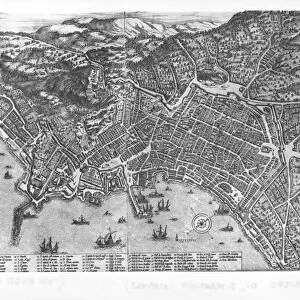
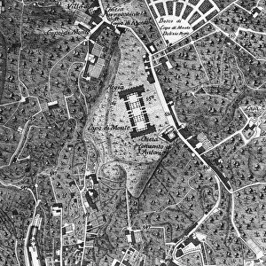
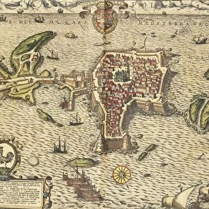
Map of Naples by Alessandro Baratta, 1629, print

![]()
Wall Art and Photo Gifts from Universal Images Group (UIG)
Map of Naples by Alessandro Baratta, 1629, print
Cartography, Italy, 17th century. Map of Naples by Alessandro Baratta, 1629
Universal Images Group (UIG) manages distribution for many leading specialist agencies worldwide
Media ID 9572539
© DEA / A. DAGLI ORTI
17th Century Black Background Direction Naples Nautical Vessel Navigation
FEATURES IN THESE COLLECTIONS
> Europe
> Italy
> Campania
> Naples
> Europe
> Italy
> Sculptures
> Universal Images Group (UIG)
> Art
> Painting, Sculpture & Prints
> Cartography
EDITORS COMMENTS
This print showcases the exquisite "Map of Naples" created by Alessandro Baratta in 1629. With a black background that adds an air of mystery, this piece takes us back to the 17th century, immersing us in the world of cartography and Italy's rich history. Baratta's map is a true work of art and craft, meticulously depicting the physical geography of Naples with remarkable detail. The horizontal composition allows for easy navigation across its intricate lines and symbols, inviting viewers to explore every nook and cranny of this ancient city. The absence of people in this studio shot emphasizes the focus on the map itself, highlighting its significance as a historical artifact. As we gaze upon it, we can't help but imagine sailors from centuries past relying on such maps to navigate their nautical vessels through treacherous waters. The Map of Naples transports us to another time, evoking a sense of wonder at how our understanding of direction and geography has evolved over centuries. It serves as a reminder that even in today's digital age, there is still immense value in studying these beautifully crafted pieces that were once essential tools for exploration. This print from Universal Images Group (UIG) captures not only Baratta's masterpiece but also our fascination with history and the artistry behind cartography. Its beauty lies not only in its aesthetic appeal but also in its ability to transport us back in time and ignite our curiosity about the world around us.
MADE IN THE USA
Safe Shipping with 30 Day Money Back Guarantee
FREE PERSONALISATION*
We are proud to offer a range of customisation features including Personalised Captions, Color Filters and Picture Zoom Tools
SECURE PAYMENTS
We happily accept a wide range of payment options so you can pay for the things you need in the way that is most convenient for you
* Options may vary by product and licensing agreement. Zoomed Pictures can be adjusted in the Cart.